Adventure Sports in Mendoza
 Argentina just keeps getting better. We´ve spent the last four days or so in Mendoza, a gorgeous and friendly city close to the border of Chile. We fell in love with the city immediately and decided we could all see ourselves living there. It is surrounded by desert, though there is a complex irrigation system that traces its way throughout the city, making it very lush and green. There are many beautiful parks, one that is quite large and reminded me a lot of Hyde Park in London, with a canal, a zoo, sports stadiums, a golf course (Jeff and Amanda went), etc. One thing that I just couldn´t get used to was the fall foliage in April. Trees are turning yellow and leaves are falling, and I can´t help but think that my birthday was two weeks ago.
 We took advantage of a few of the many activities Mendoza has to offer. We of course had to visit some more wineries, as this region produces the majority of the wine that comes out of Argentina. Once again, Malbec was my favorite wine (I spelled it wrong in my last post), pick some up if you see it in a liquor store, very smooth. We also got to visit a plant that produces olive oil, which was very cool as I got to see olive trees for the first time.
Another first was paragliding! I know this may sound crazy, especially because I am afraid of heights, but for some reason I just really wanted to try it and I´m so glad I did. It was incredible! Here I am in flight: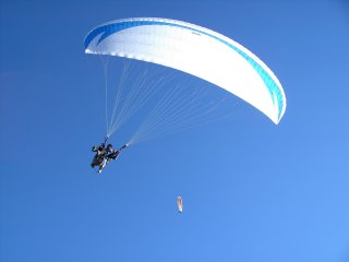
It was really cool to just float above everything and see the city from a birds-eye view (in fact, the birds were below us). My guide even did a few swirls in the air which was really fun.
The next day, Amanda and I went horseback riding through a nature preserve. We got to gallop! ´Twas great fun... great fun indeed : ) 
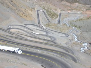
If we had lots more time, we probably would have stayed in Mendoza for weeks or even months. But alas, we must move on. Today we hopped a bus and crossed the border into Chile. The road took us on another spectacular ride through the mountains, this time cutting right from one side of the Andes to the other. And when I say some of these mountain roads are windy, I am not kidding. This road made the Kancamangus Highway look like a wide open field:
We are now in Viña del Mar, Chile, right on the Pacific coast. We will be sharing our time here with the neighboring city of Valparaíso, before heading to Santiago for a night or so.
Also, I have been looking since I started this blog for a trackable map I could post to my site so you could get a visual picture of my route. Obviously, I never found a map I could use in this way, but here is an image and a link to maps of South America, if you wish to get a better feel for the areas I am travelling in: 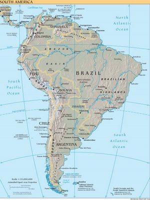
http://www.lonelyplanet.com/worldguide/destinations/south-america
http://www.cia.gov/cia/publications/factbook/reference_maps/south_america.html (same as image above but bigger)
posted by Joan @ 7:16 PM
2 comments
![]()
![]()
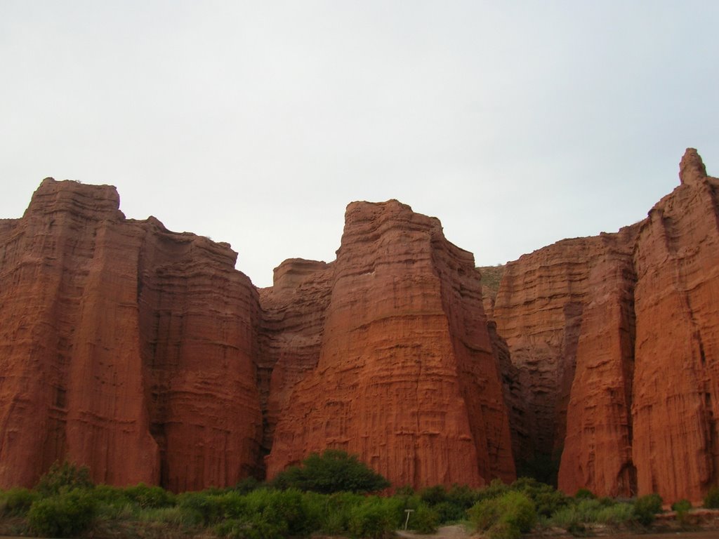
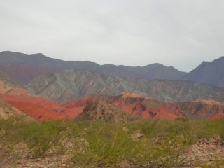
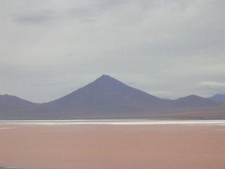
 Its been amazing to see the change in landscape from Peru to Argentina. There is so much diversity, and yet everywhere I´ve visited has been overwhelmingly beautiful (and I still haven´t even made it to Patagonia!).


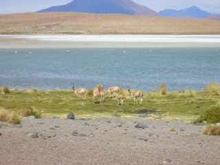
 After a night in a fly-infested room (they didn´t move from the ceiling, only threatened), the next day was my birthday!!! Here are some "firsts" I experienced on my birthday:
  Seeing flamingoes! (three different species)


 Our group had a great evening drinking wine, playing cards, and laughing our heads off! And to top it off, the next day we got up early in the morning to see geysers and bathe in natural hot springs!
  Covered in sulfur from the hot springs, we headed to the border of Chile where the tour ended. From there we caught a bus that was to take us to San Pedro, Chile, where we planned to spend the weekend before heading to Salta, Argentina. As we were getting our passports stamped in Chile, we saw a bus on the other side of the road heading to Salta. On a whim, we decided to skip San Pedro and hopped on that 10 hour bus ride to Salta! That made it three countries on one day : )
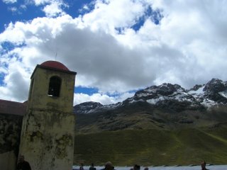 We finally arrived, tired and cranky, to Puno. We thought we would possibly leave the following day or the day after to make up some of the time we lost in Cusco because of the train strike, but low and behold there was another strike, so the first day we could leave was Thursday. After I calmed down, we decided to take a two-day tour of some of the islands in Lake Titicaca, which ended up being marvelous. The first islands we visited were two of about 80 artificial islands, made entirely of reeds. They are floating islands, with only a few meters of reeds reaching down into the water and anchors to hold them in place. There are about 2,000 people who live on these islands. The people are decendent of natives who were looking to separate themselves from both the Spanish and the Incas, so they built these islands to live away from the land. They are quite a site to see, the reeds make up everything for these people - houses, boats, and even food. Here is a scene from one of the Uros islands:
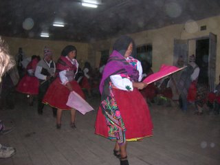
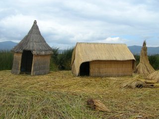 We then moved on to a natural island called Amantaní, where we stayed with a local family! I was very excited about this, I´m hoping for as many opportunities like this as I can get. The families on this island live very simple lives. They are farmers and weavers first, and tourism is becoming a large source of income for them as well. The family Amanda, Jeff, and I stayed with were so sweet and funny. They were an older couple, with kids grown and out of the house. The house was very basic - no electricity or running water, mud walls and an outhouse. It was amazingly peaceful at their home, and I fell in love with it right away. The wife, Rufina, who didn´t speak any English or Spanish, only Quechua, let me try my hand at spinning yarn from wool, which apparently I wasn´t very good at because she was laughing hysterically the whole time! It was very cute. The family dressed us up later in the evening in typical clothes of the island, and we went to the local hall to have a dance party with the other tourists and their families! It was a lot of fun. Here are some pictures:
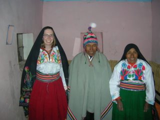
 After our night on the island we continued on to another island in the lake as well. It was a nice two days, though I still feel like I´m swaying a bit from the boat ride : )
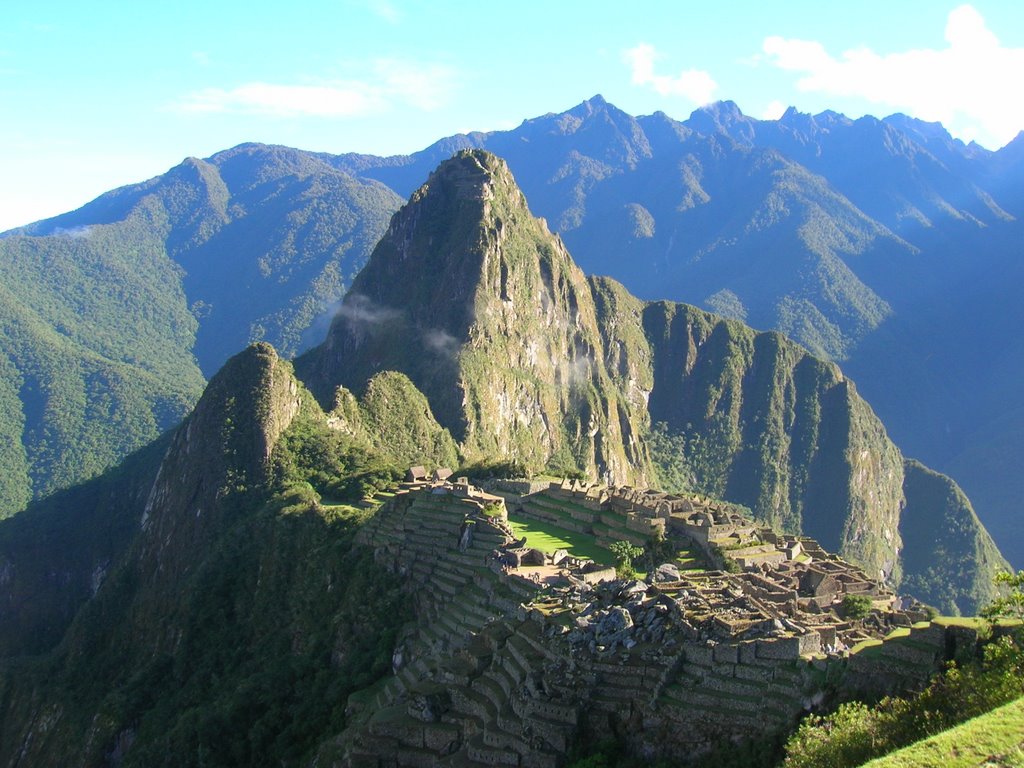
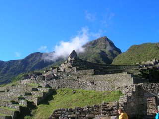
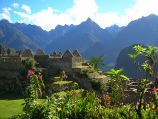
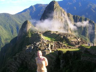 Machu Picchu is actually 1,000 meters lower than Cusco! You travel down into the valley before heading back up to the site. The way to get to Machu Picchu is to go through Aguas Calientes (or Machu Picchu town), which is only reachable by train, there are no roads. We took the backpacker train, which is the cheapest way to get there, costing $44 and requiring a two nights stay in AC. The train leaves Ollantaytambo at 8:00 at night, and heads back two mornings later at 5:45am! It is nice to have the whole day to spend at Machu Picchu, many of the other tours and day trips arrive between the hours of 10 and 2:00, so to have the morning or afternoon with less crowds is a treat. Aguas Calientes means "Hot Waters" in Spanish, and for good reason - there are hot springs in the area, which I took advantage of after our long day of hiking to rest my tired legs. We hiked to Waynapicchu, the mountain in the background of the pictures above, where the ruins continue. Between that and the hike back to town, my legs had just about had it!
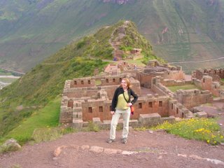
 URUBAMBA:
 Today is our recovery and blog-updating day, then tomorrow we take an all-day train to Puno on Lake Titicaca! (Go ahead and laugh, its OK.) Within the next few days we´ll be crossing the border into our next country, Bolivia!